Severe Weather Risk for Friday in the Crossroads
Showers and Thunderstorms are headed for the Crossroads tonight and tomorrow, making for a potentially soggy start to the weekend in Victoria.
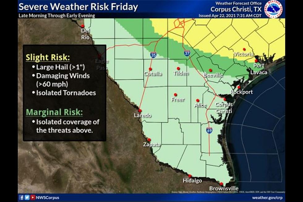
Slight Risk for Severe Storms in Victoria on Friday
Conditions for strong to severe storms could develop over part of South Texas with a slight risk extending over Victoria, and a marginal risk for the northern Coastal Bend. The main threat will include large hail, damaging winds, and a slight risk for the development of Tornadoes. The best chance for severe storms will be from early Friday afternoon until Sunset Friday.
Storms Bring a Slight Risk for Rip Currents
Remember, LOW Risk does not mean NO risk.

The National Weather Service has also issued a Small Craft Advisory which will go into effect on Friday morning and last until Saturday morning.
Storms System Expected to Arrive By Midday Friday
While the first round of showers and thunderstorms will develop late tonight and overnight, by mid-day Friday we will also start to see a wide area of storms begin to bubble up by about 11 am. These storms will develop near I-35 and begin to move eastward by lunchtime Friday. While severe weather may not reach the Crossroads anyone traveling North or Northeast is bound to encounter stronger storms.
These midday storms are expected to increase in strength as they move East. We will have to wait and see how much activity develops over the Crossroads. Once the rain moves out we will rebound nicely with temperatures in the mid-80s for the weekend. Saturday and Sunday should stay dry with Sunday being the sunnier of the two weekend days.
KEEP READING: What to do after a tornado strikes
KEEP READING: Get answers to 51 of the most frequently asked weather questions...
More From 98.7 Jack FM


